
A researcher at The University of Alabama is part of an international team that found the cause of long, potentially damaging channels on Antarctic Ice Shelves.
Dr. Prasad Gogineni, the Cudworth Professor of Engineering and director of the UA Remote Sensing Center, is co-author on a paper published today in Nature Communications that finds large rock hills deep below glaciers can cause huge channels on the ice surface — even if the hills are buried under 1.25 miles, or 2 kilometers, of ice.
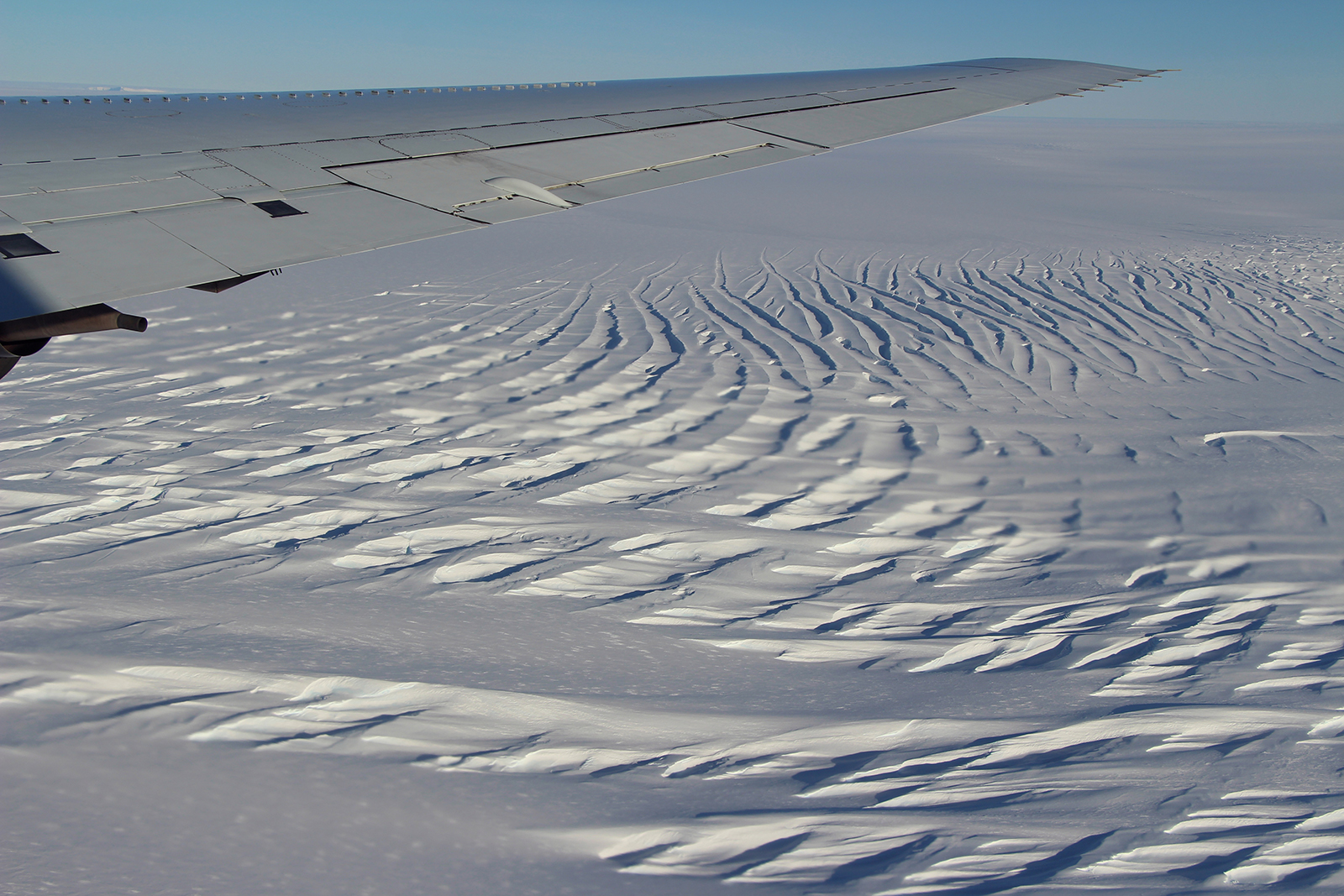
Much about Antarctic glaciers is unknown because they are remote and difficult to study, so scientists cannot be sure how they will respond to climate change. New technology , however, allows researchers to study them in detail, even looking through miles-thick glaciers to view processes occurring at their bases.
Gogineni, an internationally recognized expert in remote sensing, developed an ice-penetrating radar mounted on planes to peer to the bottom of the glacier.
“Radar data are needed to determine ice thickness and shape of the bed because satellite imagery provides information only on the surface of ice,” Gogineni said.
The study, led by researchers at Imperial College London, connected an 81-mile-long channel on the surface of an Antarctic floating ice shelf to the landscape below the ice sheet upstream.
The channel, and associated features on the ice surface, are thought to be a point of instability on the ice shelf. If the surface ice melts, water will preferentially run down these features, carving out a deeper channel and creating further weaknesses.
“This finding will help us pinpoint potential regions of Antarctica that may be of enhanced risk of change because of ice shelf channeling,” said Dr. Martin Siegert of Imperial and project leader. “It also reminds us that we can’t ignore subsurface processes — even if they are below two kilometers of ice in some of the most remote places on Earth.”
The UA Remote Sensing Center, part of the Alabama Water Institute, develops technologies that enable high-resolution measurements of soil moisture, snow and ice. UA trustees established the center when Gogineni joined UA after conducting similar research at the University of Kansas.
Gogineni was still in Kansas when working on this project.